


Washoe County (North)--Sparks City PUMA, Nevada
About
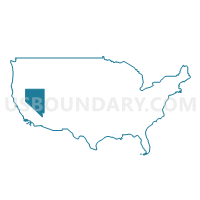
Outline
--Sparks+City+PUMA%2c+Nevada_A280.png)
Summary
| Unique Area Identifier | 193351 |
| Name | Washoe County (North)--Sparks City PUMA |
| State | Nevada |
| Area (square miles) | 6,032.63 |
| Land Area (square miles) | 5,827.67 |
| Water Area (square miles) | 204.95 |
| % of Land Area | 96.60 |
| % of Water Area | 3.40 |
| Latitude of the Internal Point | 40.76470440 |
| Longtitude of the Internal Point | -119.58753740 |
Maps
--Sparks+City+PUMA in Nevada.png)
Graphs
Select a template below for downloading or customizing gragh for Washoe County (North)--Sparks City PUMA, Nevada
--Sparks+City+PUMA%2c+Nevada_T0.png)
--Sparks+City+PUMA%2c+Nevada_T1.png)
--Sparks+City+PUMA%2c+Nevada_T2.png)
--Sparks+City+PUMA%2c+Nevada_T3.png)
--Sparks+City+PUMA%2c+Nevada_T4.png)
--Sparks+City+PUMA%2c+Nevada_T5.png)
--Sparks+City+PUMA%2c+Nevada_T6.png)
--Sparks+City+PUMA%2c+Nevada_T7.png)
--Sparks+City+PUMA%2c+Nevada.png)
Neighbors
Neighoring Public Use Microdata Area (by Name) Neighboring Public Use Microdata Area on the Map
- Carson City, Lyon, Douglas & Storey Counties PUMA, NV
- Del Norte, Lassen, Modoc, Plumas & Siskiyou Counties PUMA, CA
- Klamath, Malheur, Lake & Harney Counties PUMA, OR
- Rural Nevada PUMA, NV
- Washoe County (South Central)--Reno City PUMA, NV
- Washoe County (South) PUMA, NV
Top 10 Neighboring County (by Population) Neighboring County on the Map
- Washoe County, NV (421,407)
- Lyon County, NV (51,980)
- Lassen County, CA (34,895)
- Churchill County, NV (24,877)
- Humboldt County, NV (16,528)
- Modoc County, CA (9,686)
- Lake County, OR (7,895)
- Harney County, OR (7,422)
- Pershing County, NV (6,753)
- Storey County, NV (4,010)
Top 10 Neighboring County Subdivision (by Population) Neighboring County Subdivision on the Map
- Reno North CCD, Washoe County, NV (81,633)
- Reno Southeast CCD, Washoe County, NV (69,660)
- Sparks CCD, Washoe County, NV (57,101)
- Warm Springs-Truckee Canyon CCD, Washoe County, NV (52,378)
- North Valleys CCD, Washoe County, NV (51,813)
- Sun Valley CCD, Washoe County, NV (20,337)
- Fernley CCD, Lyon County, NV (19,519)
- Lovelock CCD, Pershing County, NV (4,839)
- Honey Lake CCD, Lassen County, CA (3,781)
- Imlay CCD, Pershing County, NV (1,914)
Top 10 Neighboring Place (by Population) Neighboring Place on the Map
- Reno city, NV (225,221)
- Sparks city, NV (90,264)
- Fernley city, NV (19,368)
- Sun Valley CDP, NV (19,299)
- Spanish Springs CDP, NV (15,064)
- Cold Springs CDP, NV (8,544)
- Lemmon Valley CDP, NV (5,040)
- Golden Valley CDP, NV (1,556)
- Wadsworth CDP, NV (834)
- Nixon CDP, NV (374)
Top 10 Neighboring Elementary School District (by Population) Neighboring Elementary School District on the Map
- Shaffer Union Elementary School District, CA (10,433)
- Ravendale-Termo Elementary School District, CA (166)
- Frenchglen School District 16, OR (82)
Top 10 Neighboring Secondary School District (by Population) Neighboring Secondary School District on the Map
- Lassen Union High School District, CA (28,166)
- Harney County Union High School District 1J, OR (1,429)
Top 10 Neighboring Unified School District (by Population) Neighboring Unified School District on the Map
- Washoe County School District, NV (421,407)
- Lyon County School District, NV (51,980)
- Churchill County School District, NV (24,877)
- Humboldt County School District, NV (16,528)
- Pershing County School District, NV (6,753)
- Storey County School District, NV (4,010)
- Fort Sage Unified School District, CA (3,324)
- Surprise Valley Joint Unified School District, CA (1,273)
- Adel School District 21, OR (97)
Top 10 Neighboring State Legislative District Lower Chamber (by Population) Neighboring State Legislative District Lower Chamber on the Map
- Assembly District 2, CA (469,582)
- Assembly District 3, CA (459,287)
- Assembly District 32, NV (80,177)
- Assembly District 26, NV (69,333)
- Assembly District 38, NV (66,836)
- State House District 55, OR (66,629)
- Assembly District 24, NV (56,482)
- State House District 60, OR (55,458)
- Assembly District 30, NV (52,226)
- Assembly District 35, NV (51,108)
Top 10 Neighboring State Legislative District Upper Chamber (by Population) Neighboring State Legislative District Upper Chamber on the Map
- State Senate District 1, CA (1,002,597)
- Washoe County Senatorial District 2, NV (136,694)
- State Senate District 28, OR (125,860)
- State Senate District 30, OR (115,913)
- Washoe County Senatorial District 3, NV (115,167)
- Central Nevada Senatorial District, NV (113,138)
- Capital Senatorial District, NV (102,155)
- Rural Nevada Senatorial District, NV (97,335)
- Washoe County Senatorial District 1, NV (92,986)
Top 10 Neighboring 111th Congressional District (by Population) Neighboring 111th Congressional District on the Map
- Congressional District 2, NV (836,562)
- Congressional District 4, CA (774,261)
- Congressional District 2, OR (769,987)
Top 10 Neighboring Census Tract (by Population) Neighboring Census Tract on the Map
- Census Tract 9601.01, Lyon County, NV (10,653)
- Census Tract 35.04, Washoe County, NV (7,355)
- Census Tract 31.06, Washoe County, NV (7,191)
- Census Tract 9601, Pershing County, NV (6,753)
- Census Tract 30, Washoe County, NV (6,653)
- Census Tract 26.17, Washoe County, NV (6,461)
- Census Tract 105, Humboldt County, NV (6,116)
- Census Tract 35.15, Washoe County, NV (6,033)
- Census Tract 26.19, Washoe County, NV (5,777)
- Census Tract 26.18, Washoe County, NV (5,609)
Top 10 Neighboring 5-Digit ZIP Code Tabulation Area (by Population) Neighboring 5-Digit ZIP Code Tabulation Area on the Map
- 89502, NV (43,566)
- 89506, NV (38,379)
- 89436, NV (36,867)
- 89431, NV (36,189)
- 89512, NV (25,574)
- 89434, NV (25,416)
- 89406, NV (24,772)
- 89433, NV (20,188)
- 89408, NV (19,626)
- 89508, NV (11,662)